
This post contains outdated information.
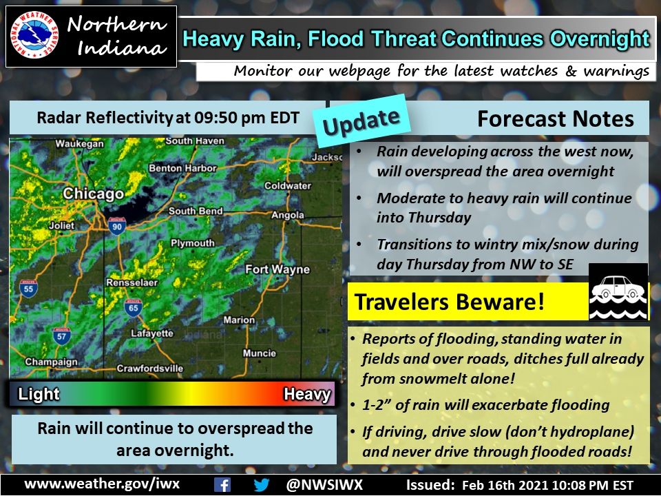
The National Weather Service warns of the threat of heavy rain and flooding overnight.
View the latest Situation Report from the National Weather Service issued at 3:07 pm on February 16, 2022.
Updated weather story from the National Weather Service:
Heavy rain and flood threat continues overnight
Fort Wayne, Indiana (February 17, 2022) – Our event is underway, with rain overspreading the area. If traveling be cautious, we’ve already received reports of full ditches and saturated fields-in addition to water over the roads in many places. This is from the snowmelt ALONE. Conditions will continue to deteriorate overnight as we see around 1-2 inches of rain from this initial wave.
If driving, drive slow to avoid hydroplaning with any water ponding on the road. Additionally, NEVER drive through flooded roadways. Turn around, don’t drown! You don’t know how deep the water is, and it’s too dark out now to really be able to see what’s going on. If you come across any water ponding over the roads, or areas of significant flooding, please let us know. We want to make sure we are alerting others of the threat. Thank you to those who have submitted reports thus far!
Visit our website for the latest information on watches, warnings, or advisories. Rain will transition to a wintry mix and eventually all snow during the day Thursday from northwest to southeast. Visit our website for specific details on your location: www.weather.gov/iwx
The latest National Weather Service weather story | Official National Weather Service Northern Indiana website
Related Images:
