
This post contains outdated information.
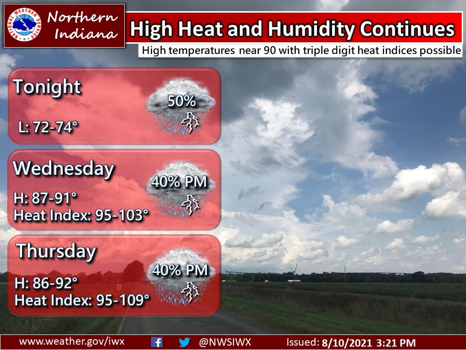
The National Weather Service is forecasting that not much relief is expected from the high heat and humidity overnight, as low temperatures only drop into the lower 70s.
Download an updated NWS Situation Report regarding dangerous heat and chances for severe storms.
High heat and humidity continues
High temperatures near 90 with triple digit heat indices possibleFort Wayne, Indiana (August 10, 2021) – Not much relief is expected from the high heat and humidity overnight, as low temperatures only drop into the lower 70s. Scattered rain/storm chances, some of which could be strong to severe, are possible tonight, tomorrow, and Thursday. On both Wednesday and Thursday, high temperatures will be in the upper 80s to lower 90s, with heat indices in the 90s to 103. With such high heat indices expected, a Heat Advisory has been issued for Wednesday, so make sure you take frequent breaks and stay hydrated if you are planning to be outside to prevent heat related illnesses. Relief won’t arrive until Friday, when both the temperatures and humidity drop.
The latest National Weather Service weather story | Official National Weather Service Northern Indiana website
Related Images:
