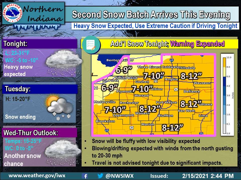
Tonight’s Fort Wayne, Indiana weather story from the National Weather Service detailing the second round of snow for our area:
This post contains outdated information.
Second round of snow arrives this evening
Heavy snow expected
Use extreme caution if driving tonight
Fort Wayne, Indiana (February 15, 2021) – The second, main batch of snow will spread across the area late this afternoon and persist overnight. 8-12” is expected for most areas with lesser amounts near Lake Michigan. The winter storm warning has been expanded to cover our entire area. The heaviest snow will be from 5pm – 1 am with snowfall rates exceeding 1”/hr for several hours. The snow will also be fluffy leading to low visibility and blowing/drifting. Wind chills will be zero to -10. Travel is not advised tonight. Snow will exit by Tuesday morning but significant impacts will likely linger through the morning hours. The next chance of snow arrives late Wednesday into Thursday.
Related information:
- Updated Winter Storm Warning – 2/15/2021-2:07 pm
- NWS: Situation Report as of 2:47 pm
- Winter Weather Travel Watch issued
- City of Fort Wayne snow removal update
- Allen County Highway Dept. roads update
- Parkview Physicians Group clinics announce closures
- Parks and Rec program changes due to snowfall
- Weather may impact COVID-19 Vaccination Clinics
- Community Harvest closed tomorrow – 2/16/2021
- Garbage collection will slow this week
- INDOT prepared for Major Winter Storm
- City: Pipes and water meters can freeze
- Official National Weather Service Northern Indiana website

