

This post contains outdated information.
The National Weather Service Northern Indiana warns that the heavy rain and flooding will continue into Thursday.
Also read about the Flood Watch in effect.
From the National Weather Service Northern Indiana:
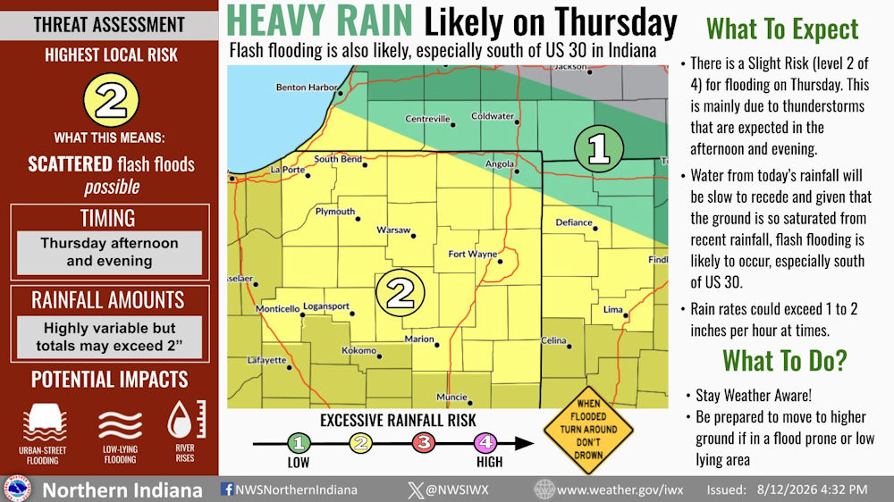
Heavy rain likely on Thursday
Flash flooding is also likely, especially south of US 30 in IndianaWhat to expect
- There is a slight risk (level 2 of 4) for flooding on Thursday. This is mainly due to thunderstorms that are expected in the afternoon and evening.
- Water from today’s rainfall will be slow to recede and given that the ground is so saturated from recent rainfall, flash flooding is likely to occur, especially south of US 30.
- Rain rates could exceed 1 to 2 inches per hour at times.
What to do?
- Stay Weather Aware!
- Be prepared to move to higher ground if in a flood prone or low lying area
Fort Wayne, Indiana (August 13, 2026 at 4:32 pm) – Heavy rain from thunderstorms Thursday afternoon and evening will renew concerns for flash flooding. Water from today’s rainfall will be slow to recede and given that the ground is so saturated from recent rainfall, flash flooding is likely to occur, especially south of US 30.
Timing:
- Thursday afternoon and evening
Rainfall amounts:
- Highly variable but totals may exceed 2″
Potential Impacts
- Urban street flooding
- Low lying flooding
- River rises
REMEMBER – When flooded, TURN AROUND, DON’T DROWN.
Related Images: