

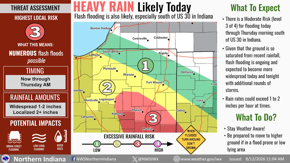
The National Weather Service warns that multiple rounds of heavy rain from thunderstorms will exacerbate flash flooding.
From the National Weather Service Northern Indiana:
Fort Wayne, Indiana (August 12, 2026 at 11:04am) Multiple rounds of heavy rain from thunderstorms will exacerbate flash flooding. Rain rates could exceed 1 to 2 inches per hour at times. Flash flooding is ongoing or expected to become more widespread today and tonight with additional rounds of storms.
What to Expect
- There is a Moderate Risk (level 3 of 4) for flooding today through Thursday morning south of US 30 in Indiana.
- Given that the ground is so satuarated from recent rainfall, flash flooding is ongoing and expectedd to become more widespread today qand tonight with additional rounds of storms.
- Rain rates could exceed 1 to 2 inches per hour at times.
What to Do?
- Stay Weather Aware!
- Be prepared to move to higher ground if in a flood prone or low lying area
Related Images: