

This post contains outdated information.
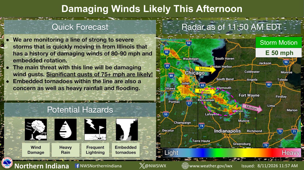
The National Weather Service warns of a line of strong to severe storms that is quickly moving into our area from Illinois that has a history of damaging winds of 80-90 mph and embedded rotation.
Download the latest NWS Situation Report.
See also – Flood Watch and Severe Thunderstorm Watch
Quick Forecast:
- We are monitoring a line of strong to severe storms that is quickly moving in from Illinois that has a history of damaging winds of 80-90 mph and embedded rotation.
- The main threat with this line will be damaging wind gusts. Significant gusts of 75+ mph are likely!
- Embedded tornadoes within the line are also a concern as well as heavy rainfall and flooding.
Potential Hazards:
- Wind Damage
- Heavy Rain
- Frequent Lightning
- Embedded Thunderstorms
We are monitoring a line of strong to severe storms that is quickly moving in from Illinois that has a history of damaging winds and embedded rotation. These storms are expected to maintain their strength with significant gusts of 75+ mph likely across our area this afternoon.
Related Images: