

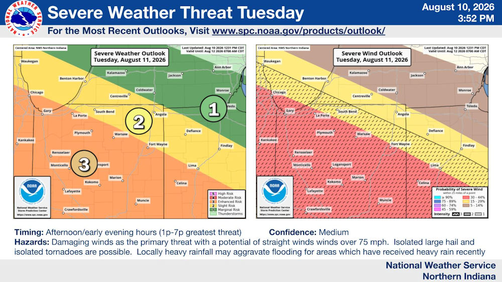
The National Weather Service is forecasting another round of thunderstorms for Tuesday afternoon.
Tonight’s National Weather Service weather story for Fort Wayne, Indiana:
Fort Wayne, Indiana (August 10, 2026) – Another round of thunderstorms is expected Tuesday afternoon. There is increasing concern on the potential of damaging wind gusts with a line of thunderstorms in the afternoon with a potential of damaging wind gusts in excess of 75 mph. Isolated large hail is possible along with the risk of an isolated tornado.
Timing: Afternoon/early evening hours (1p – 7p greatest threat)
Confidence: Medium
Hazards: Damaging winds as the primary threat with a potential of straight winds over 75 mph. Isolated large hail and isolated tornadoes are possible. Locally heavy rainfall may aggravate flooding for areas which have received heavy rain recently.
Download the latest NWS Situation Report | Official National Weather Service Northern Indiana website
Related Images: