
The National Weather Service reports that there is a potential for severe weather on Monday, April 27, 2026.
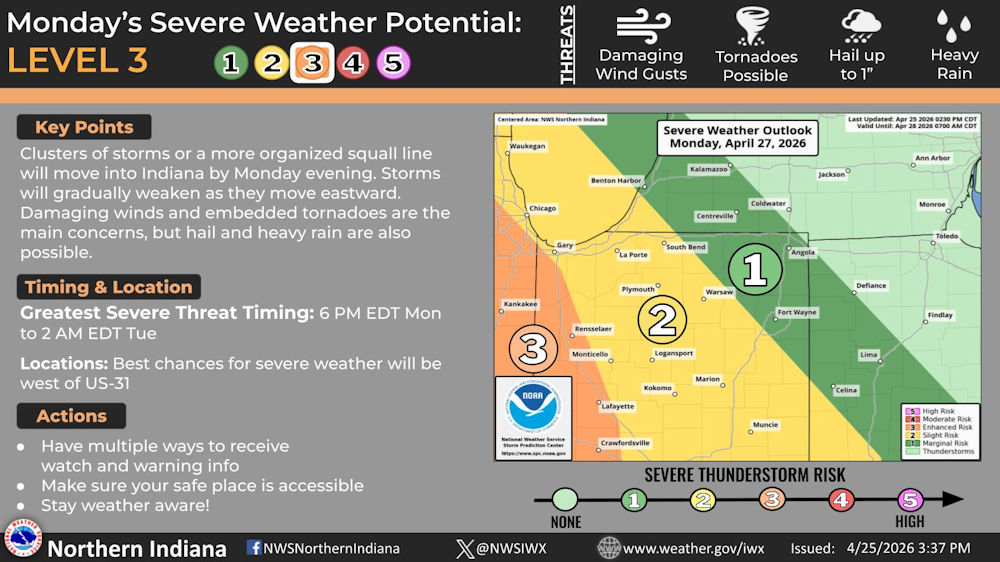
Key Points
Clusters of storms or a more organized squall line will move into Indiana by Monday evening. Storms will gradually weaken as they move eastward. Damaging winds and embedded tornadoes are the main concerns, but hail and heavy rain are also possible.
Timing and Location
Greatest Severe Threat Timing: 6 PM EDT Monday to 2 AM EDT Tue
Locations: Best chances for severe weather will be west of US 31
Actions
- Have multiple ways to receive watch and warning info
- Make sure your safe place is accessible
- Stay weather aware!
We continue to monitor potential for severe weather Monday evening into Monday night. Damaging winds and embedded tornadoes are the main concerns, but hail and heavy rain are also possible. The best chances for severe weather will be west of US-31.
Related Images:


