
This post contains outdated information.
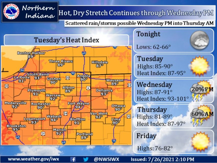
The National Weather Service is forecasting overnight lows will drop into the low to 65 under mostly clear skies. with calm winds.
Hot and dry continues through Wednesday PM
Scattered rain and storms possible Wednesday night into Thursday morningFort Wayne, Indiana (July 26, 2021) – This week remains hot, humid, and dry until rain chances provide some relief towards the end of the week. Tonight, lows drop into the low to mid 60s under mostly clear skies. The hot and dry stretch looks to continue into the middle of the week, with highs near 90 both Tuesday and Wednesday. Heat indices both days range from the low to mid 90s. Make sure if you are planning to be outside, you wear sunscreen, have ways to stay hydrated, and take frequent breaks to prevent becoming overheated. Late Wednesday night into early Thursday morning, a cold front looks to move through, bringing chances for scattered rain and storms, plus some cooler, drier air. Thursday will be slightly cooler with highs in the low to mid 80s, with peak heat index values in the 90s. Humidity levels will drop to end the week, as highs on Friday will be below average in the upper 70s to low 80s.
The latest National Weather Service weather story | Official National Weather Service Northern Indiana website
Related Images:
