
This post contains outdated information.
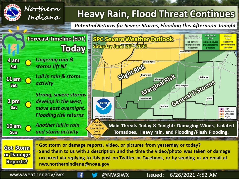
Today’s Fort Wayne, Indiana weather story from the National Weather Service:
Heavy rain and flood threat continue
Potential returns for severe storms
Flooding this afternoon-tonightForecast Timeline Today:
- 4:00 am Saturday – Lingering rain and storms life northeast
- 11:00 am Saturday – Lull in rain and storm activity
- 2:00 pm
- 10 am Sunday – Another lull in rain and storm activity
Fort Wayne, Indiana (June 26, 2021) – The heavy rain and flooding threat continues today and tonight as additional rounds of showers and thunderstorms are expected. We’ll see the rain and storm activity early this morning lift northeast out of the area. We may see somewhat of a lull in rain and storm activity between 11 am and 2 pm EDT before the next round moves in. Similarly to yesterday and last night, we’ll see the potential for heavy rain, flooding, and strong to severe storms develop in the afternoon (west half) and continue eastward overnight. The main threats are heavy rain and flooding/flash flooding, but any strong to severe storms that develop could produce damaging winds and isolated tornadoes. Additional chances for showers and storms return after another morning lull in activity on Sunday. If you have any storm or damage reports, videos, or photos from yesterday and last night, please send them to us via social media or our email with a description and time the damage/storm occurred at nws.northernindiana@noaa.gov
The latest National Weather Service weather story | Official National Weather Service Northern Indiana website
Related Images:
