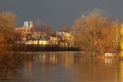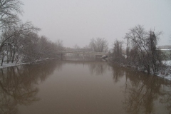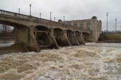
The National Weather Service has issued Flood Warnings for area rivers until June 29th, 7:15 a.m.:
FLOOD WARNING
NATIONAL WEATHER SERVICE NORTHERN INDIANA
703 PM EDT SUN JUN 28 2015
INC003-033-087-113-151-MIC023-059-149-OHC003-039-051-069-125-137-161-171-291115-
/O.EXT.KIWX.FA.W.0019.000000T0000Z-150629T1115Z/
/00000.0.ER.000000T0000Z.000000T0000Z.000000T0000Z.OO/
DE KALB IN-ALLEN IN-LAGRANGE IN-NOBLE IN-STEUBEN IN-ST. JOSEPH MI-
BRANCH MI-HILLSDALE MI-PAULDING OH-VAN WERT OH-PUTNAM OH-WILLIAMS OH-
FULTON OH-DEFIANCE OH-HENRY OH-ALLEN OH-
703 PM EDT SUN JUN 28 2015THE NATIONAL WEATHER SERVICE IN NORTHERN INDIANA HAS EXTENDED THE
* FLOOD WARNING FOR…
- DE KALB COUNTY IN NORTHEASTERN INDIANA…
- ALLEN COUNTY IN NORTHEASTERN INDIANA…
- LAGRANGE COUNTY IN NORTHEASTERN INDIANA…
- EASTERN NOBLE COUNTY IN NORTHEASTERN INDIANA…
- STEUBEN COUNTY IN NORTHEASTERN INDIANA…
- ST. JOSEPH COUNTY IN SOUTHWESTERN MICHIGAN…
- BRANCH COUNTY IN SOUTHWESTERN MICHIGAN…
- HILLSDALE COUNTY IN SOUTHEASTERN MICHIGAN…
- PAULDING COUNTY IN WEST CENTRAL OHIO…
- VAN WERT COUNTY IN WEST CENTRAL OHIO…
- PUTNAM COUNTY IN WEST CENTRAL OHIO…
- WILLIAMS COUNTY IN NORTHWESTERN OHIO…
- FULTON COUNTY IN NORTHWESTERN OHIO…
- DEFIANCE COUNTY IN NORTHWESTERN OHIO…
- HENRY COUNTY IN NORTHWESTERN OHIO…
- NORTHERN ALLEN COUNTY IN WEST CENTRAL OHIO…
* UNTIL 715 AM EDT MONDAY
* AT 700 PM EDT…EMERGENCY MANAGEMENT AND TRAINED SPOTTERS REPORTED WIDESPREAD FLOODING ACROSS MUCH OF THE WARNED AREA. TWO TO 5 INCHES OF RAIN FELL OVER THE AREA ON SATURDAY…RESULTING IN A COMBINATION OF STREAM…RIVER…LOWLAND AND POOR DRAINAGE FLOODING THAT WILL PERSIST THROUGH THE OVERNIGHT HOURS. A STATE OFÂ EMERGENCY HAS BEEN DECLARED IN HENRY COUNTY OHIO.
* SOME LOCATIONS THAT WILL EXPERIENCE FLOODING INCLUDE…FORT WAYNE…DEFIANCE…NEW HAVEN…AUBURN…STURGIS…COLDWATER…VAN WERT…KENDALLVILLE…NAPOLEON…ANGOLA…BRYAN…HILLSDALE…THREE RIVERS…WAUSEON…DELPHOS…GARRETT…OTTAWA…ARCHBOLD…BLUFFTON…DESHLER AND MONTPELIER.
PRECAUTIONARY/PREPAREDNESS ACTIONS…
MOST FLOOD DEATHS OCCUR IN AUTOMOBILES. NEVER DRIVE YOUR VEHICLE INTO AREAS WHERE THE WATER COVERS THE ROADWAY. FLOOD WATERS ARE USUALLY DEEPER THAN THEY APPEAR. JUST ONE FOOT OF FLOWING WATER IS POWERFUL ENOUGH TO SWEEP VEHICLES OFF THE ROAD. WHEN ENCOUNTERING FLOODED ROADS MAKE THE SMART CHOICE…TURN AROUND…DONT DROWN.
EXCESSIVE RUNOFF FROM HEAVY RAINFALL WILL CONTINUE TO CAUSE EXTENSIVE FLOODING OF SMALL CREEKS AND STREAMS…HIGHWAYS AND UNDERPASSES IN URBAN AREAS. ADDITIONALLY…COUNTRY ROADS AND FARMLANDS ALONG THE BANKS OF CREEKS…STREAMS AND OTHER LOW LYING AREAS ARE SUBJECT TO FLOODING.
BE ESPECIALLY CAUTIOUS AT NIGHT WHEN IT IS HARDER TO RECOGNIZE THE DANGERS OF FLOODING. NEVER DRIVE PASSED ROAD CLOSED BARRIERS.
&&
LAT…LON 4086 8434 4082 8434 4082 8440 4069 8440
4073 8446 4073 8479 4093 8481 4092 8531
4117 8532 4128 8520 4154 8565 4176 8566
4176 8570 4205 8576 4206 8436 4171 8436
4172 8388 4086 8388
FLOOD STATEMENT
NATIONAL WEATHER SERVICE NORTHERN INDIANA
350 PM EDT SUN JUN 28 2015…The flood warning has been extended for the following rivers…
- Mississinewa River near Marion affecting Grant…Miami and Wabash Counties
- Salamonie River below Warren affecting Blackford…Huntington…Jay…Wabash and Wells Counties
- Tippecanoe River near Ora affecting Fulton…Kosciusko…Marshall…Pulaski and Starke Counties
- Wabash River near Linn Grove affecting Adams and Wells Counties
- Wabash River near Bluffton affecting Huntington and Wells Counties
- Auglaize River near Defiance Power Plant affecting Defiance County
- Blanchard River at Ottawa affecting Putnam County
- Maumee River AT Ft. Wayne affecting Allen and Paulding Counties
- Maumee River near Defiance affecting Defiance and Henry Counties
- Maumee River at Napoleon affecting Henry County
- Saint Joseph River Ohio below Montpelier affecting Williams County
- Saint Joseph River Ohio near St. Joe River Ft. Wayne affecting Allen County
- Saint Marys River near Decatur affecting Adams…Allen and Van Wert Counties
- Saint Marys River at Muldoon Bridge affecting Allen County
…The flood warning continues for the following rivers…
- Little River above Huntington affecting Allen…Huntington and Wabash Counties
- Tippecanoe River above Winamac affecting Carroll…Pulaski and White Counties
- Wabash River at Wabash affecting Cass…Miami and Wabash Counties
- Eel River at North Manchester affecting Cass…Kosciusko…Miami…Wabash and Whitley Counties
- Auglaize River near Ft. Jennings affecting Allen…Paulding and Putnam Counties
- Saint Joseph River Ohio above Newville affecting Allen…De Kalb and Defiance Counties
- Tiffin River near Stryker affecting Defiance…Fulton and Williams Counties
.Recent heavy rains have led to rises on area rivers. Additional rainfall is expected overnight.
PRECAUTIONARY/PREPAREDNESS ACTIONS…
Safety message…Never drive vehicl00es through flooded areas. the water may be too deep to allow safe passage. Never allow children to play in or near flood waters. Stay tuned to NOAA Weather Radio or local media for further statements and updated forecasts.
Detailed river forecasts and more information can be found on the internet at www.weather.gov/iwx under Hydrology… Rivers and Lakes.
All times are in Eastern Time. This statement will be updated in about 24 hours or sooner if necessary.
&&
INC003-069-169-291950-
/O.CON.KIWX.FL.W.0044.000000T0000Z-150630T1524Z/
/LRHI3.2.ER.150627T0953Z.150628T2000Z.150629T1524Z.NO/
350 PM EDT SUN JUN 28 2015The Flood Warning continues for The Little River above Huntington
* until Tuesday morning.
* At 3 PM Sunday the stage was 16.7 feet and steady.
* Moderate flooding is occurring and Moderate flooding is forecast.
* Flood stage is 15.0 feet.
* Forecast…The river will rise to a crest near 17.5 feet around 4 PM Sunday June 28 and fall below flood stage around 11 AM Monday June 29.
* At 18.0 feet…Extensive flooding is in progress.
* This crest compares to a previous crest of 17.8 feet which occurred on May 27 2011.&&
LAT…LON 4086 8570 4097 8537 4096 8533 4088 8542
4080 8568
The Maumee River at Fort Wayne:
INC003-OHC125-291950-
/O.EXT.KIWX.FL.W.0054.000000T0000Z-150703T1040Z/
/FTWI3.2.ER.150627T1331Z.150629T0600Z.150702T1040Z.NO/
350 PM EDT SUN JUN 28 2015The Flood Warning has been extended for The Maumee River AT Ft. Wayne
* until Friday morning.
* At 3 PM Sunday the stage was 21.3 feet and rising.
* Moderate flooding is occurring and Moderate flooding is forecast.
* Flood stage is 17.0 feet.
* Forecast…The river will rise to a crest near 21.6 feet around 2 AM Monday June 29 and fall below flood stage around 6 AM Thursday July 2.
* At 22.0 feet…Flooding becomes serious. Twenty-four hour flood fighting commences if river continues to rise.
* This crest compares to a previous crest of 21.1 feet which occurred on May 27 2011.&&
LAT…LON 4107 8513 4110 8511 4110 8505 4113 8495
4111 8492 4106 8503
The St. Joseph River at Fort Wayne:
INC003-033-OHC039-291949-
/O.CON.KIWX.FL.W.0060.000000T0000Z-000000T0000Z/
/NVLI3.2.ER.150627T2040Z.150629T1200Z.000000T0000Z.NO/
350 PM EDT SUN JUN 28 2015The Flood Warning has been extended for The Saint Joseph River Ohio near St. Joe River Ft. Wayne
* until Tuesday afternoon.
* At 3 PM Sunday the stage was 13.4 feet and rising.
* Minor flooding is occurring and Minor flooding is forecast.
* Flood stage is 12.0 feet.
* Forecast…The river will rise to a crest near 13.8 feet around 8 PM Sunday June 28 and fall below flood stage around 4 PM Monday June 29.&&
LAT…LON 4118 8507 4118 8506 4118 8505 4117 8505
4117 8506
The St. Marys River at Fort Wayne:
INC003-291949-
/O.EXT.KIWX.FL.W.0048.000000T0000Z-150630T1938Z/
/SASI3.1.ER.150627T1545Z.150629T0000Z.150629T1938Z.NO/
350 PM EDT SUN JUN 28 2015The Flood Warning has been extended for The Saint Marys River at Muldoon Bridge
* until Tuesday afternoon.
* At 2 PM Sunday the stage was 15.6 feet and rising.
* Minor flooding is occurring and Minor flooding is forecast.
* Flood stage is 14.0 feet.
* Forecast…The river will rise to a crest near 15.7 feet around 8 PM Sunday June 28 and fall below flood stage around 3 PM Monday June 29.
* At 15.0 feet…Flooding occurs on the lowest unprotected city streets, park drives and county roads.
* This crest compares to a previous crest of 16.1 feet which occurred on Feb 13 2009.&&
LAT…LON 4104 8518 4109 8516 4109 8512 4104 8514
4094 8504 4093 8506
