


The National Weather Service reports that the threat of severe storms will increase this afternoon.
Download the latest National Weather Service Situation Report.
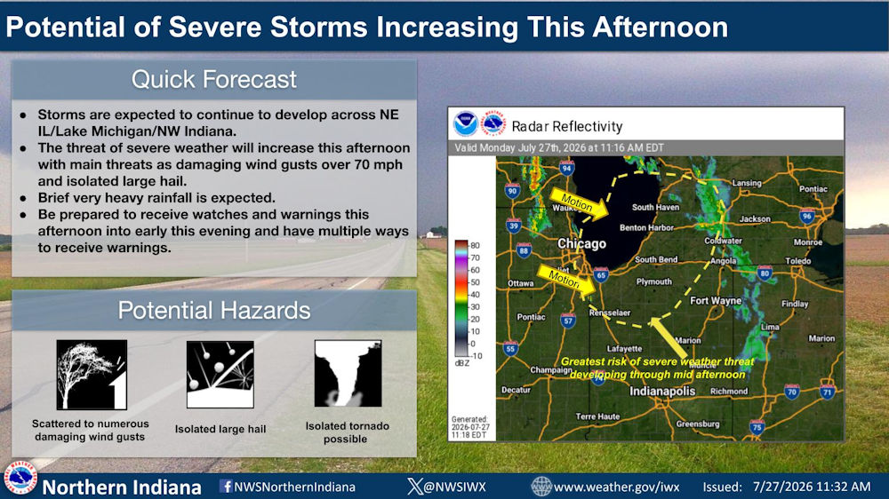
Quick Forecast
- Storms are expected to continue to develop across Northeast Illinois/Lake Michigan/Northwest Indiana.
- The threat of severe weather will increase this afternoon with main threats as damaging wind gusts over 70 mph and isolated large hail.
- Brief very heavy rainfall is expected.
- Be prepared to receive watches and warnings this afternoon into early this evening and have multiple ways to receive warnings.
Potential Hazards
- Scattered to numerous damaging wind gusts
- Isolated large hail
- Isolated tornado possible
Fort Wayne, Indiana (July 27, 2026) – The threat of severe storms will increase this afternoon. Storms are developing across portions of Lake Michigan and northern Illinois and will pose some severe threat as they shift eastward this afternoon.
Through 3pm EDT, the greatest risk of severe weather will begin to shift east across SW Lower MI/and portions of NW IN. Be prepared for watches and warnings today, and have multiple ways to receive warnings. Damaging winds in excess of 70 mph represent the greatest threat, but isolated large hail and isolated tornadoes cannot be ruled out.
Related Images: