
Tonight’s weather story from the National Weather Service:
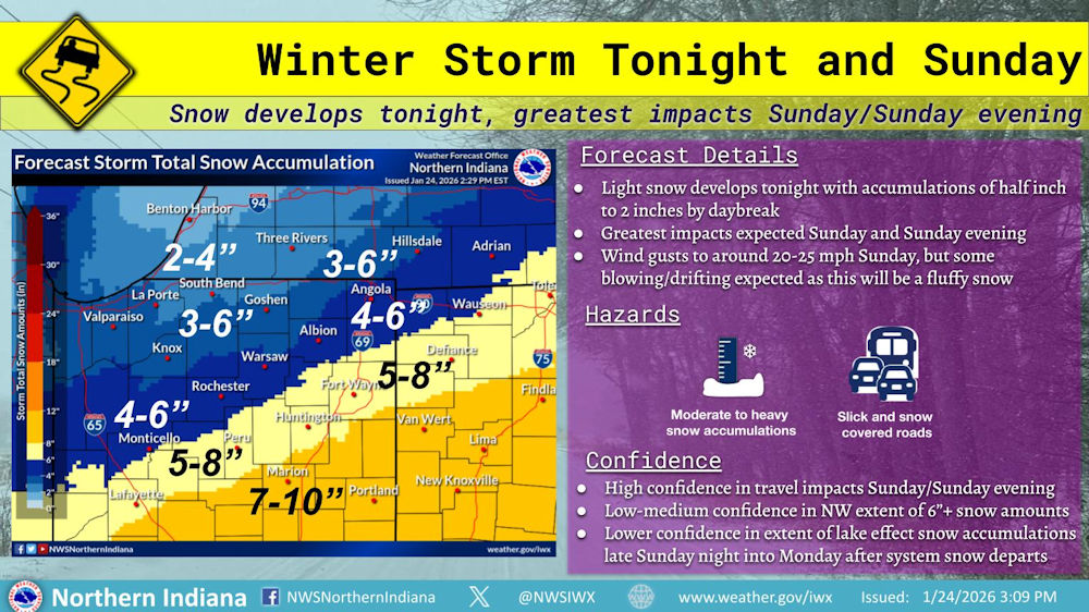
Winter Storm Tonight-Sunday
Snow develops tonight, greatest impacts Sunday/Sunday evening(January 24, 2026) – Snow is expected to overspread the area from south to north tonight with light snow accumulations. The primary impacts are expected Sunday and Sunday evening with moderate to heavy snow accumulations and greater travel impacts. Snow will taper Sunday evening, but hazardous travel potential continues through Sunday night.
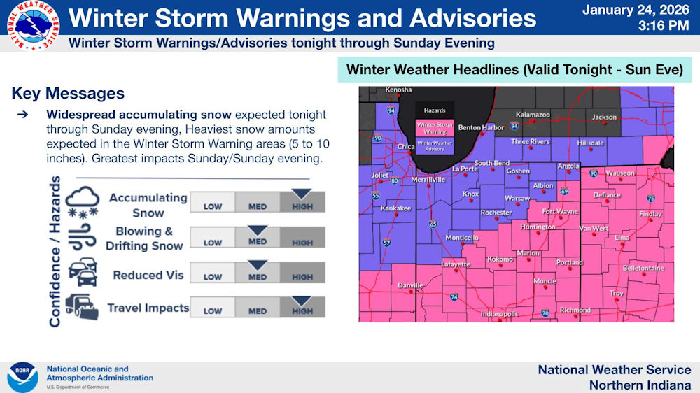
Winter Storm Warnings and Advisories
Winter Storm Warnings/Advisories tonight through Sunday Evening(January 26, 2026) – Winter storm warnings (pink) and winter weather advisories (purple) remain in effect tonight through Sunday evening. The heaviest snow amounts of 7 to 10 inches are expected in the warning area, with 3 to 7 inches in the advisory area. Confidence is high in travel impacts for Sunday.
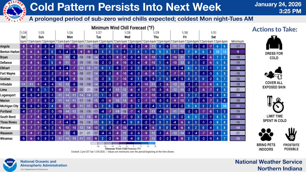
Cold pattern persists into next week
A prolonged period of sub-zero wind chills expected; coldest Monday night thru Tuesday AM(January 26, 2026) – Wind chills of 10 below to 20 below are expected again Sunday night through early Tuesday. The much below normal temperatures will continue through much of the week.
Download the latest National Weather Service Situation Report.
Related Images:
