
This post contains outdated information.
The National Weather Service is forecasting a significant early season winter storm for our area this weekend.
Download the NWS Situation Report from 11/29/2025 at 0425 hours.
From the National Weather Service:
Significant early season winter storm
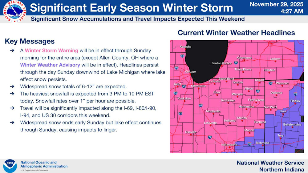
(November 29, 2025) – A Winter Storm Warning will be in effect through Sunday morning for the entire area (except Allen County, OH where a Winter Weather Advisory will be in effect). Widespread snow totals of 6-12” are expected.
Key Messages:
- A Winter Storm Warning will be in effect through Sunday morning for the entire area (except Allen County, OH where a Winter Weather Advisory will be in effect). Headlines persist through the day Sunday downwind of Lake Michigan where lake effect snow persists.
- Widespread snow totals of 6-12″ are expected.
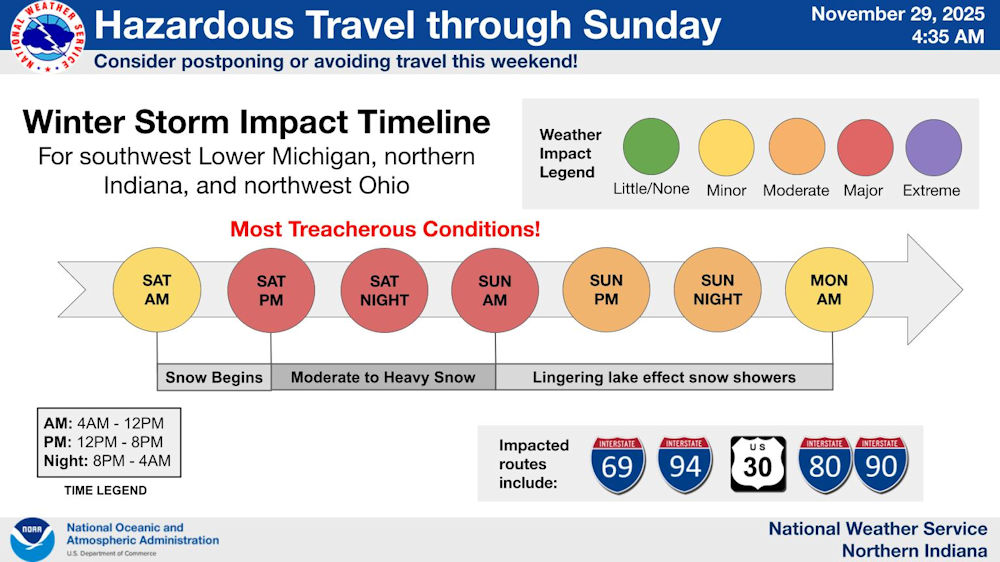
- The heaviest snowfall is expected from 3 PM to 10 PM EST today. Snowfall rates over 1″ per hour are possible.
- Travel will be significantly impacted along the I-69, I-80/I-90, I-94, and US 30 corridors this weekend.
- Widespread snow ends early Sunday but lake effect continues through Sunday, causing impacts to linger.
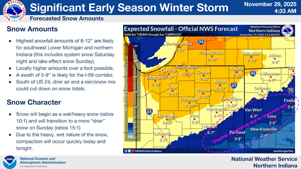
Snow Amounts
- Highest snowfall amounts of 8-12″ are likely for southwest Michigan and northern Indiana (this includes system snow Saturday night and lake effect snow Sunday).
- Locally higher amounts over a foot possible.
- A swath of 5-9″ is likely for the I-69 corridor.
- South of US 24, drier air and a rain/snow mix could cut down on snow totals.
Snow Character
- Snow will begin as a wet/heavy snow (ratios 10:1) and will transition to a more “drier” snow on Sunday (ratios 15:1)
- Due to the heavy, wet nature of the snow, compaction will occur quickly today and tonight.
Related links:
- Click here for the latest posts on this winter storm.
- Download a map of the City’s Snow Plow Routes.
- 2018 City of Fort Wayne Snow Policies and Procedures
- Shovel Smart! National Weather service infographic.
- Listen to your heart when battling winter weather
Related Images:


