
Today’s weather story from the National Weather Service:
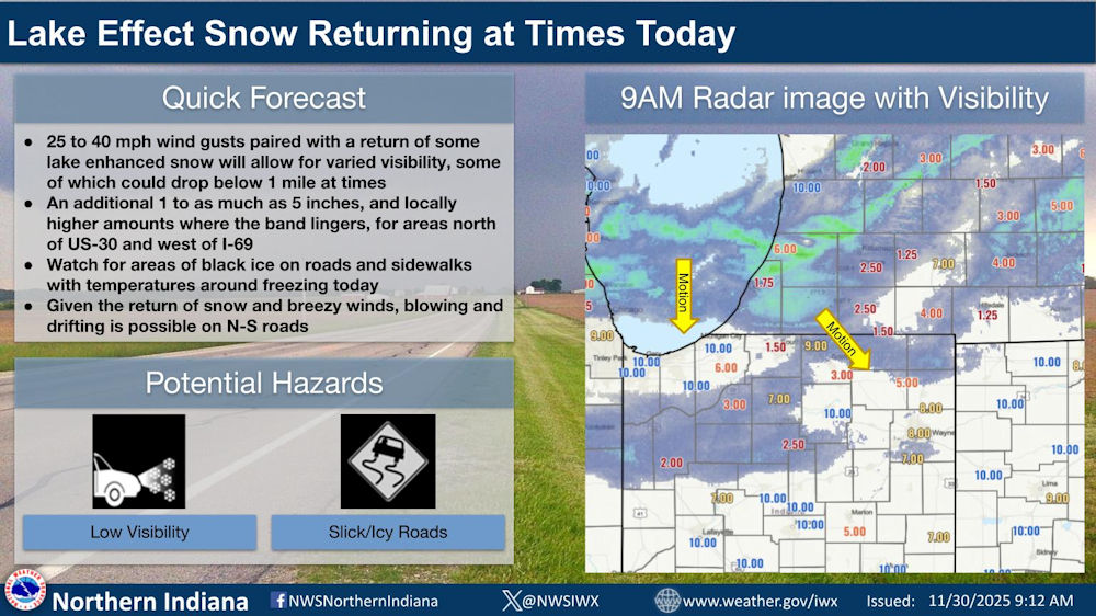
Lake Effect Snow returning at times today
Quick Forecast
- 25 to 40 mph wind gusts paired with a return of some lake enriched snow will allow for varied visibility, some of which could drop below 1 mile at times.
- An additional 1 to as much as 5 inches, and locally higher amounts where the band lingers, for areas north of US-30 and west of I-69
- Watch for areas of black ice on roads and sidewalks with temperatures around freezing today
- Given the return of snow and breezy winds, blowing and drifting is possible on north-south roads
Fort Wayne, Indiana (November 30, 2025) – Lake effect snow pushes through this morning into the afternoon and then another band of lake effect snow pushes in later this afternoon. Watch for slick spots and low visibility leading to areas of treacherous driving. Conditions will be variable in and out of these bands.
Download the latest National Weather Service Situation Report.
Related Images:


