
Tonight’s weather story from the National Weather Service:
Download the latest NWS Situation Update.
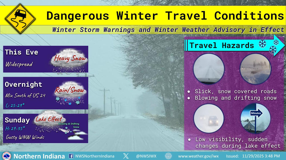
Dangerous Winter Travel Conditions
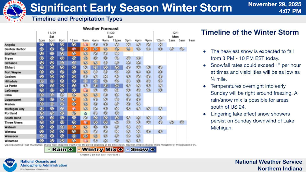
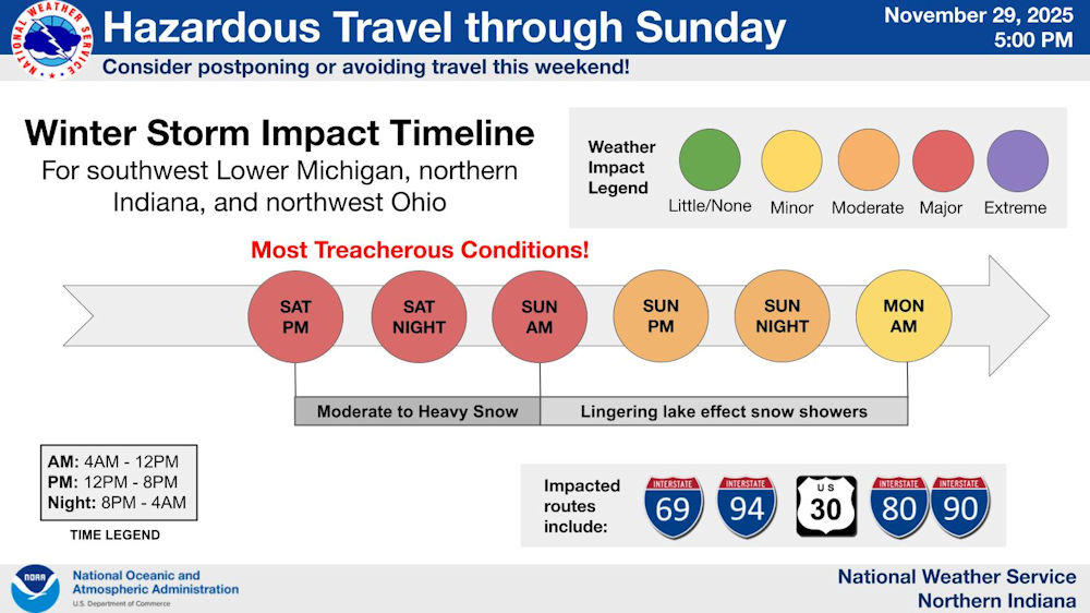
Winter Storm Warnings and Winter Weather Advisory in EffectFort Wayne, Indiana (November 29, 2025) – Widespread snow is expected across the area through this evening, then overnight areas south of US 24 will mix with rain. Sunday we’ll see mostly snow once again, with a transition to more lake effect snow for W-NW wind favored areas (snow tapering off further inland). It will be windy with gusty W-NW winds. Travel will be dangerous, with slick snow covered roads and some blowing and drifting (especially Sunday in areas that received greater snow totals). Visibility will be low through the event. Once we transition to lake effect, visibility may improve but be wary of sudden reductions if you are driving between snow bands. Visibility could go from clear to near zero in minutes. Visit weather.gov/iwx for the latest warnings, advisories, and snow totals for your area.
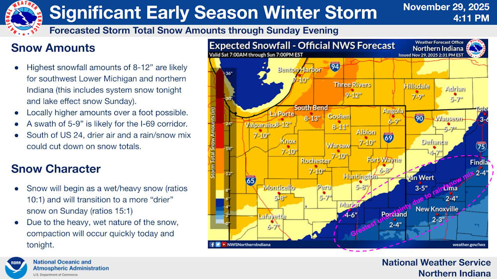
Snow Amounts
- Highest snowfall amounts of 8-12″ are likely for southwest Michigan and northern Indiana (this includes system snow Saturday night and lake effect snow Sunday).
- Locally higher amounts over a foot possible.
- A swath of 5-9″ is likely for the I-69 corridor.
- South of US 24, drier air and a rain/snow mix could cut down on snow totals.
Snow Character
- Snow will begin as a wet/heavy snow (ratios 10:1) and will transition to a more “drier” snow on Sunday (ratios 15:1)
- Due to the heavy, wet nature of the snow, compaction will occur quickly today and tonight.
Related links:
- Click here for the latest posts on this winter storm.
- Download a map of the City’s Snow Plow Routes.
- 2018 City of Fort Wayne Snow Policies and Procedures
- Shovel Smart! National Weather service infographic.
- Listen to your heart when battling winter weather
Related Images:


