Webmaster’s note: Visit the official National Weather Service Northern Indiana website for the latest weather updates. This post contains outdated information.
Tonight’s weather story from the National Weather Service:
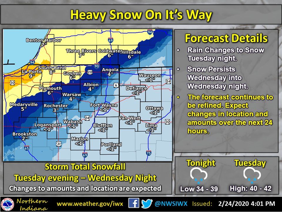
Snow on it’s way
(February 24, 2020) – Snow is on its way. The same system that is bringing our rainfall today will bring snow starting Tuesday night. Snow is expected all day on Wednesday before diminishing late Wednesday night. As the forecast stands right now, the heaviest snowfall is expected across NW Indiana and southern Lower Michigan. With that being said, the location of heaviest snowfall has been shifting south over the past few days. If this trend continues, then the higher amounts could be further south than what is currently forecast. It is very important to watch for later forecast updates to see if you will be affected by heavy snow.

