
Tonight’s Fort Wayne, Indiana weather story from the National Weather Service:
This post contains outdated information.
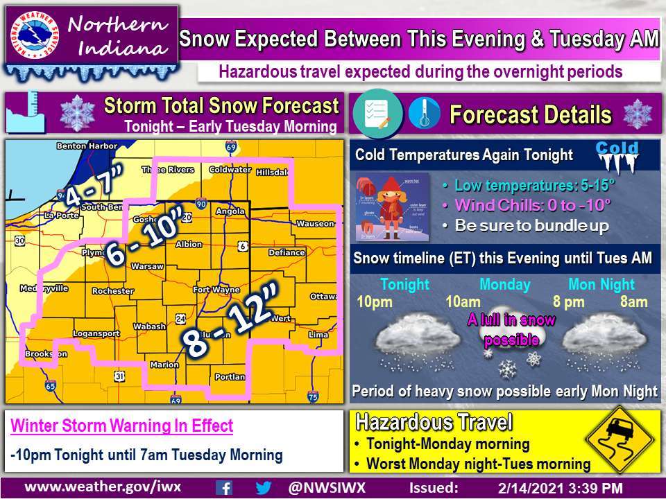
Snow expected between this evening and Tuesday AM
Hazardous travel expected during the overnight periodsFort Wayne, Indiana (February 14, 2021) – The latest snowfall forecast has shifted northwest and most of the area is now under a winter storm warning for tonight through Tuesday morning. Storm total amounts of 8-12” are expected south of US-24 with 6-10” north of there and 4-7” closer to Lake Michigan where a winter weather advisory is in effect.
Light lake effect snow is ongoing but more widespread snow will expand from southwest to northeast this evening and will continue into Monday morning. There will be a lull Monday afternoon before more widespread snow moves back into the area again Monday night.
The heaviest snow will be 7pm-1am Monday night. Travel will be hazardous tonight into Monday morning but the worst conditions will be Monday night into Tuesday morning.
Looking ahead to Wednesday night to Thursday night, another system will have to be watched for the potential for more snow.
Related information: