
This post contains outdated information.
Webmaster’s note: Visit the official National Weather Service Northern Indiana website for the latest weather updates.
Today’s weather story from the National Weather Service:
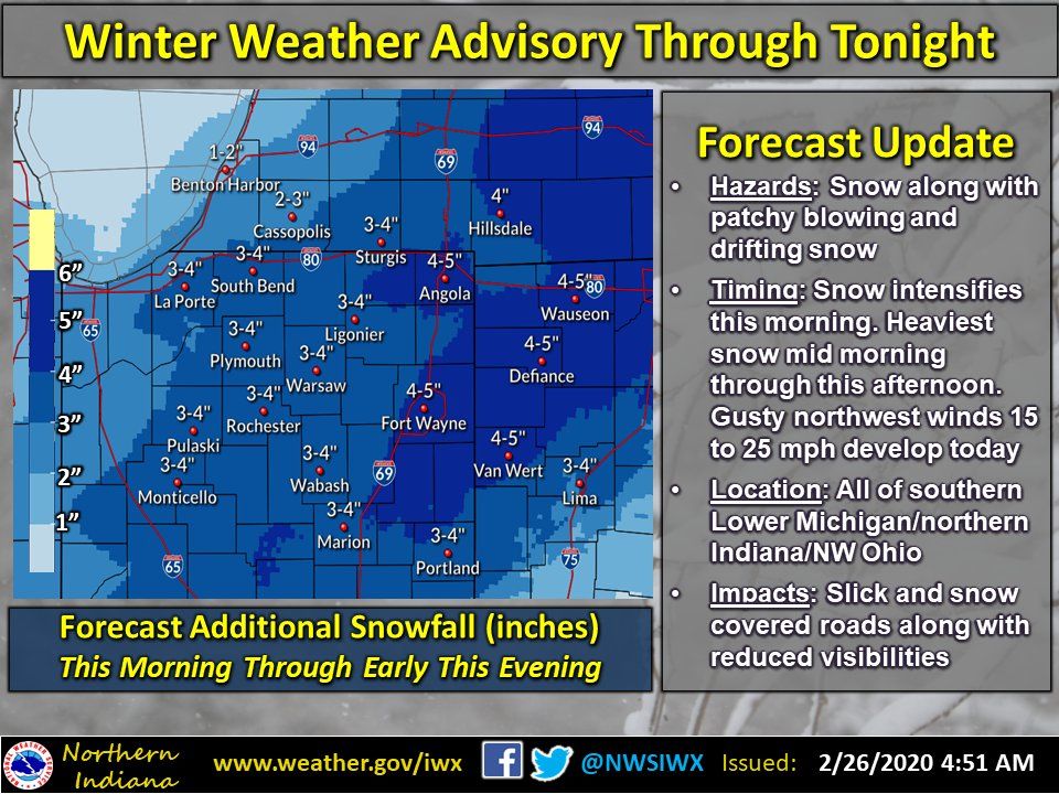
Winter Weather Advisory through tonight
(February 26, 2020) – After a lull in the snowfall overnight, snow will increase in intensity from west to east this morning into this afternoon. The heaviest snowfall is expected from mid morning through this afternoon. Additional snowfall amounts of 2 to 5 inches are expected today with the greatest amounts across northeast Indiana, south central Lower Michigan, and northwest Ohio. In addition to slick and snow covered roads today, north winds will increase to 15 to 25 mph which will create some blowing and drifting snow, especially across rural open areas this afternoon into early this evening. The evening commute tonight will likely be impacted. Some lake effect snow showers are expected to persist into the overnight hours tonight, but additional snow accumulations with the lake effect snow are expected to be less than an inch.