Monday, 4/27
Wednesday, 4/29
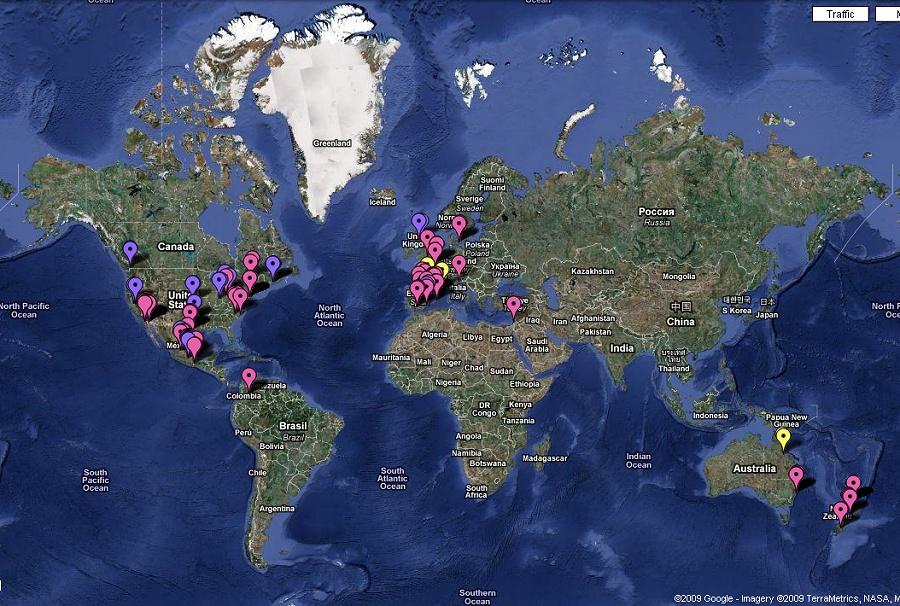
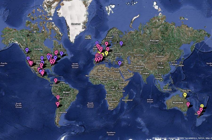
I’ve found more information about this map and it’s authenticity. Â One of the things you cannot really grasp with the above photos has been the number of increased reported cases in the clusters. Â Click here for the current map.
The source of this map does indeed appear to be authentic. Â From a Pittsburg, Pennsylvania television station:
Pittsburgh-Area Researcher Tracking Swine Flu Online
Another Area Doctor Spearheads Swine Flu Task ForcePosted: 5:40 pm EDT April 28, 2009
Updated: 6:18 pm EDT April 28, 2009A Pittsburgh-area researcher is tracking the spread of the swine flu outbreak online.
“We just started,” said Dr. Henry Niman. “The government already expressed an interest.”
Niman is the researcher responsible for a computer-generated map that shows how and where the swine flu is spreading worldwide. He spent his career studying the evolution of viruses.
The map shows instances of suspected and confirmed cases, and its up-to-the-minute tracking of the virus has the government interested in the information it can provide.
“The spread is probably more than what is represented by the dots on the map because they are really trailing (the progress of the virus),” said Niman.
Even though I would really love to, I’m not going to comment on the reporter, except to point out it’s reporters like her that are probably giving the government a reason to think about renaming the Swine Flu. Â (Swine Virus?)
Related Images:


