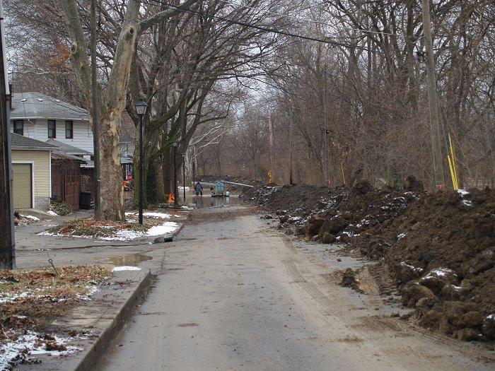
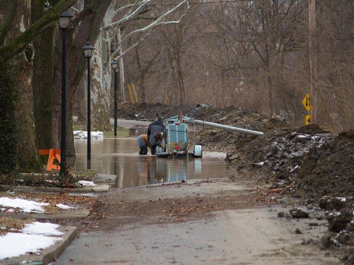
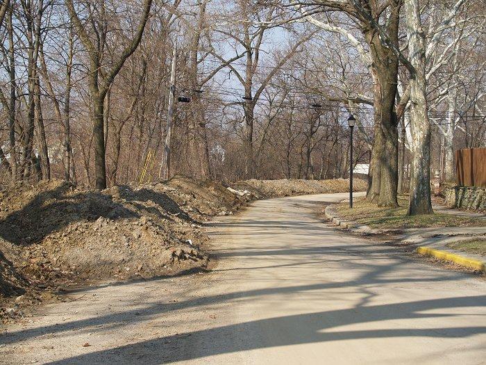
If you cut across to Washington Boulevard from Main Street, you have noticed the clay levee partially blocking Thieme Drive. This levee was placed last February during the flooding.
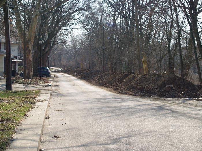
I sent an email to Kim Steier, the City’s Flood Control Manager inquiring about the levees and their removal. She forwarded my inquiry to Tom Cain, who is with the City’s Redevelopment Department. The clay levee will be removed around the end of April as the highest risk for flooding will be pass at that point.
I had also asked about possible solutions in the area. I know from walking and driving the area that one of the biggest readily apparent problems is that the river bank is right up against the Thieme Drive road bed. There is hardly any room for a permanent levee or even flood wall to be constructed there. But even if there would be room available, at several neighborhood meetings that specifically involved Thieme, Berry and Nelson Street residents, residents were opposed to the design standards of the Army Corps of Engineers who would be the possible prime funding source for any flood mitigation project in the area. Residents and Rivergreenway users are also opposed to obscuring the view of the river by any type of wall or levee.
To protect the area against a 100-year flood event, a possible levee/wall would need to be over 6′ tall at the lowest point on the street – the Berry and Thieme intersection. For contrast, the current clay levee is a couple of feet shy of the needed 6′ elevation. Residents have shared with the City that the views are very important to those living in the area. In fact, residents in the area willingly pay flood insurance premiums, which are not cheap, for the unobstructed views.
But residents in the area state that their historic flood problems have been mostly due to basement seepage. Soil bore samples have subsequently been completed and show the area to be filled with layers of cinder and other permeable material. This material is 25′ deep in places along Thieme Drive and allows flood water to seep laterally into basements due to easy water table movement.
I was living on Park Avenue during the July 2003 flooding of the St. Mary’s River. It wasn’t the flood waters that inundated our basement, it was the back up of the river through the sewage pipes. Of course, in the long run, it was better this happened because water pressure on the walls of an empty basement increase the risk of a house’s collapse.
Anyway, getting back to the Thieme Drive area, correcting the basement flooding in the area, which is the major concern of residents, would require a very deep barrier against moving groundwater. The expense of protecting the area with a wall or sheet piling long the west side of the drive would be cost prohibitive and is therefore not considered feasible at this time.Â
One option that has not been considered would be a slurry wall like the one installed around the Harrison Square project area. In the January 31, 2008 meeting of the Redevelopment Commission, Greg Leatherman stated that the slurry wall installed at Harrison Square, “…is working very well.” Gary Lyman, Brownfield Specialist, added that currently they are pumping an average of 80 gallons per minute from the site which is substantially less than anticipated.


A slurry wall could be placed under Thieme Drive and would protect the basements from flooding. According to Cain, this option is not something the Corps of Engineers normally employs.  To put slurry walls in perspective, one was constructed around the World Trade Center complex during it’s construction in the late 60s and became known in engineering circles as “The Bathtub”. The Bathtub stopped the Hudson River from backing up into the complex and in fact, prevented further damage from flooding river water during the 9/11 events and aftermath. For more information about slurry walls, view this Wikipedia article.Â
But again, a possible slurry wall would only prevent basements from backing up. Meanwhile, above-ground flood protection walls along property frontages would require excavation to a depth that would endanger and in all probability kill trees in the area by damaging their root systems. The trees in the area are considered a required historic landscape feature, especially if Federal construction funds were secured. This wall would require openings for access to residences which would have to be blocked off during flooding.
At this point, no other options have been put forward. Instead, the City if focusing on other flood control projects until a financially and aesthetically feasible compromise or solution is found.
Again, thanks to Kim and Tom for their assistance!
Photos Links:
February 7, 2008 Thieme Drive Flood photos
February 2008 Flood photos index
Flood photos index
Previous Blog Posts:
Flooding Category
Related Images:


